Cartogram
Showing the single result
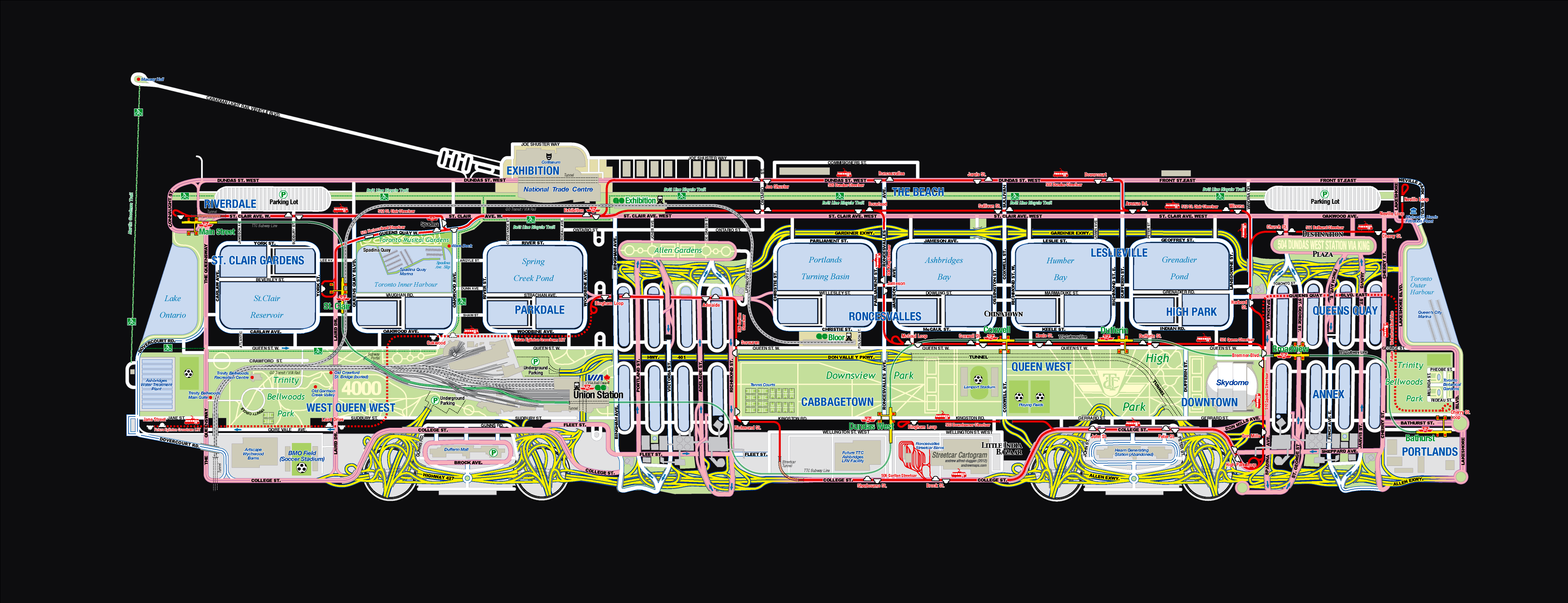
Streetcar Cartogram
Winner of “Best in Show” Spacing Magazine!
This Streetcar Cartogram builds an imaginary city space in the shape of a Toronto streetcar using a common city-map template. Under close examination, the streetcar is less evident revealing an urban form more congruent with a normal city-map. Toronto has always identified itself as being a streetcar city, and is now in the difficult political process of trying to define its suburban periphery in a similar way with the addition of LRT lines.